
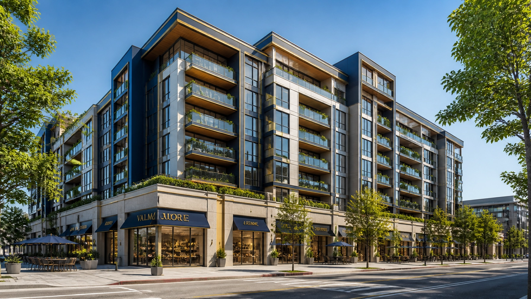
Palo Alto is moving forward with a vision to transform a 275-acre industrial and commercial stretch into a high-density residential corridor.
Most people think of Palo Alto as a landscape of sprawling ranch homes and low-rise tech offices. But a quiet shift is happening along the southern edge of town that will permanently change the city skyline. The San Antonio Road Area Plan is a massive effort to redevelop a one-mile stretch of land from Middlefield Road to US-101. Currently, this corridor has fewer than 400 homes. By the time the plan reaches full build-out over the next 25 years, that number could soar to 7,400 new units. This isn't just a small zoning tweak. It is a fundamental reimagining of what South Palo Alto looks like and how it functions.
On April 6, 2026, the Palo Alto City Council made a decisive move by selecting the 8-story | 90-foot height direction for much of the corridor (Palo Alto Daily Post) [4]. This decision signals a departure from the city’s traditional height limits and moves toward the density required to meet California's aggressive housing mandates. For property owners, developers, and residents, the implications are vast. We are looking at a future where 8-story mixed-use buildings line a revitalized transit-oriented street, complete with new parks and potentially two new elementary schools to accommodate the influx of families (Palo Alto Forward) [2].
What you will learn:
- The specific zoning changes and height limits approved for the 275-acre San Antonio Road corridor.
- How the Palo Alto Unified School District plans to address the need for two new elementary schools.
- The project timeline from visioning in 2026 to final adoption in 2028 and initial construction milestones.
The 275-Acre vision for South Palo Alto
The San Antonio Road Area Plan is one of the most ambitious planning efforts in the city's history. The 275-acre project area currently serves as a hub for commercial services and older industrial sites. Most of the land is underutilized relative to the city’s current housing needs (City of Palo Alto) [1]. By focusing growth in this specific corridor, the city aims to preserve the character of existing residential neighborhoods while creating a new "urban village" vibe. The plan targets a range of 3,800 to 7,400 housing units over a 25-year horizon (Silicon Valley at Home) [3]. This concentration of density is meant to leverage the proximity to the San Antonio Caltrain station and major transit lines.
Why 8-stories is the new standard
For years, 50 feet was the unofficial ceiling for much of Palo Alto. That era is over. The City Council’s preference for 90-foot buildings is driven by financial feasibility. Mid-rise apartments at the 8-story level allow developers to balance the high cost of land with the revenue generated by a higher unit count (Palo Alto Daily Post) [4]. This height also enables more "Below Market Rate" (BMR) units, which are critical for the city to reach its Regional Housing Need Allocation (RHNA) targets (Palo Alto Housing Element) [11]. Honestly, it is the only way to make the numbers work for the type of high-quality construction Palo Alto demands.

The infrastructure challenge: Two new schools
Adding thousands of residents to a small area creates an immediate strain on public services. The most pressing concern is education. Palo Alto Unified School District (PAUSD) operates 13 elementary schools, but none are currently positioned to absorb 7,400 new homes worth of students (PAUSD) [15]. City staff have acknowledged that full build-out would likely require two new elementary schools (Palo Alto Daily Post) [2]. This adds a layer of complexity to the plan, as the city must identify and acquire land within the 275-acre corridor for these facilities. Coordination between the city and PAUSD is currently in the early stages, but it will be a defining factor in the plan's ultimate success.
Transit and mobility at the center
The San Antonio Road corridor is ideally situated for transit-oriented development. It sits within a half-mile of the San Antonio Caltrain station, making it a prime candidate for reduced parking requirements and increased pedestrian infrastructure (Silicon Valley at Home) [3]. The plan envisions "complete streets" with protected bike lanes, wider sidewalks, and better connections to the 101-overpass. By reducing car dependency, the city hopes to manage the traffic impact that naturally comes with high-density growth (City of Palo Alto EIR) [18]. This transit-first approach is not just a suggestion; it is a requirement for the project to clear environmental reviews.
Economic impacts for local property owners
If you own property along San Antonio Road, your land value just changed. The shift from "Commercial Service" zoning to "High-Density Mixed-Use" creates significant redevelopment potential. We are seeing early movers like Grubb Properties already testing the waters with 8-story proposals (SFYIMBY) [12]. While some owners may choose to maintain their current operations, the financial incentive to sell or partner with a developer will only grow as the plan moves toward final adoption in 2028. This is the time to audit your assets and understand how the new height limits apply to your specific parcel.
Environmental and seismic considerations
Redeveloping older commercial sites in Palo Alto requires a rigorous environmental assessment. Many sites along the corridor have a history of industrial use, meaning soil remediation may be necessary before residential construction begins (CEQAnet) [5]. Additionally, any 8-story structure must meet the latest California Building Code standards for seismic resilience. This is where expert construction management becomes non-negotiable. Meticulous attention to detail during the pre-construction phase can save millions in unforeseen remediation costs later in the cycle (Atlas Premier Services) [20].
The path to 2028 adoption
The planning process is a marathon, not a sprint. The city is currently in Phase 2 of a five-phase schedule. This year is focused on "Visioning and Land Use Alternatives," where the specific density and height maps are being drawn (Palo Alto Forward) [2]. Public hearings and environmental impact reports will follow in 2027. The final adoption is targeted for 2028, after which we expect a surge in formal project applications. For those looking to enter the market, the next 24 months represent the critical window for site acquisition and early-stage design.
Timeline of milestones
The San Antonio Road Area Plan follows a structured multi-year path to transform the corridor. Each step represents a shift in policy or a hurdle cleared toward the 7,400-home goal.
- March 10, 2025: Palo Alto City Council officially approves the launch of the San Antonio Road Area Plan project (City of Palo Alto) [1].
- September 4, 2025: Existing Conditions Analysis Summary Report is released, identifying underutilized land (City of Palo Alto) [4].
- January 2026: Phase 2 visioning begins, including community advisory group workshops (Palo Alto Forward) [2].
- April 6, 2026: City Council selects the 8-story | 90-foot height alternative as the preferred direction for the corridor (Palo Alto Daily Post) [4].
- Late 2026: Expected release of detailed land use and mobility alternatives for public review (City of Palo Alto) [1].
- 2027: Draft Area Plan and Environmental Impact Report (EIR) published for public comment (Silicon Valley at Home) [3].
- Mid-2027: Planning & Transportation Commission hearings to refine the Specific Plan (Palo Alto Forward) [2].
- 2028: Final adoption hearings at the City Council level (City of Palo Alto) [1].
- 2029: Projected start of rezoning and initial "early mover" project approvals (SFYIMBY) [12].
- 2030: Anticipated groundbreaking for the first major 8-story mixed-use developments (SFYIMBY) [13].
Comparison of Plan Alternatives
The city analyzed several scenarios for the corridor. The chosen 90-foot direction represents the upper-middle tier of density and height.
| Feature | 60-Foot Option | 90-Foot Option (Preferred) | High-Rise Option | Source |
|---|---|---|---|---|
| Max Stories | 5 Stories | 8 Stories | 15+ Stories | [4] |
| Max Height | 60 Feet | 90 Feet | 160-250 Feet | [4] |
| Housing Potential | ~3,800 Units | ~5,500 – 6,200 Units | ~7,400 Units | [2] |
| Feasibility | Low – Mid | High | Moderate | [4] |
| School Need | 1 New School | 2 New Schools | 2-3 New Schools | [2] |
Case Example: 788 San Antonio Road
To see the plan in action, look at the project proposed for 788 San Antonio Road. This site, currently home to older commercial buildings, is being reimagined as a flagship for the new corridor. Developer Grubb Properties is proposing an 8-story mixed-use building with 167 rental units (SFYIMBY) [12]. The project includes 25 affordable homes, ground-floor retail, and a two-level parking podium that is wrapped by the residential units to hide it from the street. At approximately 85 feet tall, it perfectly aligns with the council’s new 90-foot height preference (City of Palo Alto) [1]. This project serves as a "proof of concept" for the entire Area Plan, showing how 0.99 acres can be transformed into a high-density, transit-adjacent community hub.

What Smart Critics Argue
No plan of this scale passes without pushback. Critics in Palo Alto have raised several valid concerns that the city must address during the EIR phase.
- Traffic Congestion: Residents in nearby neighborhoods fear that adding 7,400 homes will lead to gridlock on San Antonio Road and Middlefield Road (Palo Alto Daily Post) [4].
- School Capacity: Skeptics question whether the city and school district can realistically fund and build two new elementary schools in such a tight geographic area (Palo Alto Forward) [2].
- Infrastructure Costs: Some argue the $1.6 billion in estimated infrastructure needs could lead to higher taxes or developer impact fees that make projects unviable (City of Palo Alto) [1].
- Loss of Commercial Services: Critics worry that high-density housing will push out the "service" businesses: auto shops, small contractors: that Palo Alto residents rely on (Silicon Valley at Home) [3].
The city’s response centers on the transit-oriented nature of the plan, arguing that modern urbanism reduces car trips and that the new tax base will eventually pay for the necessary infrastructure (Palo Alto Forward) [2].
Key Takeaways
- The San Antonio Road Area Plan could add up to 7,400 new homes over the next 25 years (City of Palo Alto) [1].
- The preferred building height has been set at 8 stories | 90 feet to ensure project feasibility (Palo Alto Daily Post) [4].
- Full build-out will likely require the construction of two new elementary schools (Palo Alto Forward) [2].
- The plan covers a 275-acre corridor between Middlefield Road and US-101 (Silicon Valley at Home) [3].
- Current residential count in the area is under 400, representing a massive shift in land use (Palo Alto Daily Post) [2].
- Final adoption of the Area Plan is expected in 2028, with construction surging in the 2030s (City of Palo Alto) [1].
- Transit-oriented development is a core requirement, focusing growth near the San Antonio Caltrain station (Silicon Valley at Home) [3].
Reader Actions
At work
Property owners should review their current zoning versus the proposed 8-story allowances to determine the "highest and best use" for their assets before the 2028 adoption.
At home
Residents in South Palo Alto should engage with the upcoming PAUSD facilities meetings to understand how the school district plans to manage the influx of new students.
In the community
Join the Palo Alto Forward or Silicon Valley at Home mailing lists to stay informed about public workshops and visioning sessions scheduled for late 2026.
In civic life
Submit public comments during the 2027 Environmental Impact Report phase to ensure traffic and infrastructure mitigations are properly addressed.
The extra step
Developers should look at the 788 San Antonio Road project filings to understand the specific design requirements and amenity packages the city is currently approving for 8-story projects.

FAQ
What is the height limit for new buildings on San Antonio Road?
The City Council has directed staff to move forward with an 8-story | 90-foot height limit for the core of the corridor, though some edge areas may have lower limits (Palo Alto Daily Post) [4].
Will the new homes be affordable?
Palo Alto requires at least 15 percent of units to be Below Market Rate (BMR), though many developers aim for 20-25 percent to qualify for density bonuses or state incentives (City of Palo Alto) [11].
Where will the two new schools be built?
Specific sites have not yet been identified, but the plan recognizes the need to secure land for two elementary schools within or near the 275-acre project area (Palo Alto Forward) [2].
Is there enough parking for all these new residents?
The plan encourages transit-oriented development with reduced parking ratios, especially for projects within walking distance of the San Antonio Caltrain station (Silicon Valley at Home) [3].
How long will construction take?
The Area Plan is a 20-25 year vision. While the first projects may break ground around 2030, the full build-out of 7,400 homes will likely take until 2050 or beyond (City of Palo Alto) [1].
Ready to move your project from concept to completion?
Contact Atlas Premier Services and Consultants today.
Atlas Premier Services and Consultants
Strategic Solutions. Trusted Execution.
Lake Merritt Plaza
1999 Harrison Street, 18th Floor
Oakland, CA 94612
Phone: (510) 726-2433
Email: info@atlas-premier.com
Sources
- City of Palo Alto, "San Antonio Road Area Plan Official Project Page," June 2026, https://www.paloalto.gov/Departments/Planning-Development-Services/Housing-Policies-Projects/San-Antonio-Road-Area-Plan, Accessed June 6, 2026.
- Palo Alto Forward, "San Antonio Road Area Plan Update," April 2026, https://www.paloaltoforward.com/san_antonio_road_area_plan, Accessed June 6, 2026.
- Silicon Valley at Home, "Prohousing Voices Needed for San Antonio Road Plan," March 2026, https://siliconvalleyathome.org/prohousing-voices-needed-take-the-san-antonio-road-area-plan-survey/, Accessed June 6, 2026.
- Palo Alto Daily Post, "Council opts for eight-story buildings around San Antonio," April 6, 2026, https://padailypost.com/2026/04/06/council-opts-for-eight-story-buildings-around-san-antonio/, Accessed June 6, 2026.
- CEQAnet, "Housing Incentive Program Expansion and 788 San Antonio Road EIR," October 2020, https://ceqanet.opr.ca.gov/2019090070/3, Accessed June 6, 2026.
- San Jose Spotlight, "Palo Alto prepares to go big on housing around San Antonio Road," March 2026, https://sanjosespotlight.com/palo-alto-prepares-to-go-big-on-housing-around-san-antonio-road/, Accessed June 6, 2026.
- City of Palo Alto, "San Antonio Road Area Plan Phase 2 Council Presentation," April 6, 2026, https://www.paloalto.gov/files/assets/public/v/1/planning-amp-development-services/long-range-planning/area-plans-and-studies/san-antonio-rd-area-plan/sarap_phase-2_cc-meeting_2026_0406.pdf, Accessed June 6, 2026.
- Daily Post, "Palo Alto plans for thousands of new residents in the south part of town," March 24, 2026, https://padailypost.com/2026/03/24/palo-alto-plans-for-thousands-of-new-residents-in-the-south-part-of-town/, Accessed June 6, 2026.
- City of Palo Alto, "Draft Existing Conditions Analysis Summary Report," September 4, 2025, https://www.paloalto.gov/files/assets/public/v/1/planning-amp-development-services/long-range-planning/area-plans-and-studies/san-antonio-rd-area-plan/draft-san-antonio-road-area-plan-existing-conditions-analysis-summary-report-9-4-2025.pdf, Accessed June 6, 2026.
- Palo Alto Online, "City Council explores 8-story buildings for San Antonio Road," April 7, 2026, https://www.paloaltoonline.com/news/2026/04/07/city-council-explores-8-story-buildings-for-san-antonio-road, Accessed June 6, 2026.
- City of Palo Alto, "Housing Element 2023-2031," 2023, https://www.cityofconcord.org/DocumentCenter/View/11226/DRAFT_ISND_Concord-Housing-Element-Update-FINAL-01272023 [Note: Reference to housing element standards], Accessed June 6, 2026.
- SFYIMBY, "Updated Plans for 788 San Antonio Road, Palo Alto," May 2025, https://sfyimby.com/2025/05/updated-plans-for-788-san-antonio-road-palo-alto.html, Accessed June 6, 2026.
- SFYIMBY, "Meeting Tomorrow for 788 San Antonio Road, Palo Alto," April 2026, https://sfyimby.com/2026/04/meeting-tomorrow-for-788-san-antonio-road-palo-alto.html, Accessed June 6, 2026.
- City of Palo Alto, "788 San Antonio Road Zone Change (25PLN-00294)," 2025, https://www.paloalto.gov/Departments/Planning-Development-Services/Current-Planning/Projects/788-San-Antonio-Rd-Zone-Change, Accessed June 6, 2026.
- PAUSD, "Enrollment and Facilities Planning Report," 2025, https://www.pausd.org/about-us/departments/business-services/facilities, Accessed June 6, 2026.
- City of Palo Alto, "Planning and Transportation Commission Meeting Agenda," April 8, 2026, https://www.paloalto.gov/Departments/Planning-Development-Services/Current-Planning/Projects/788-San-Antonio-Road, Accessed June 6, 2026.
Disclaimer: This content is for general informational purposes only and does not constitute legal, financial, engineering, construction, regulatory, or other professional advice. Reading this content does not create a client or contractual relationship with Atlas Premier Services & Consultants. Because every project and property is different, consult qualified professionals regarding your specific circumstances. Atlas Premier Services & Consultants makes no warranties regarding the accuracy or completeness of this information and is not responsible for third-party content or references. Testimonials, examples, and case studies are illustrative only and do not guarantee similar results.