
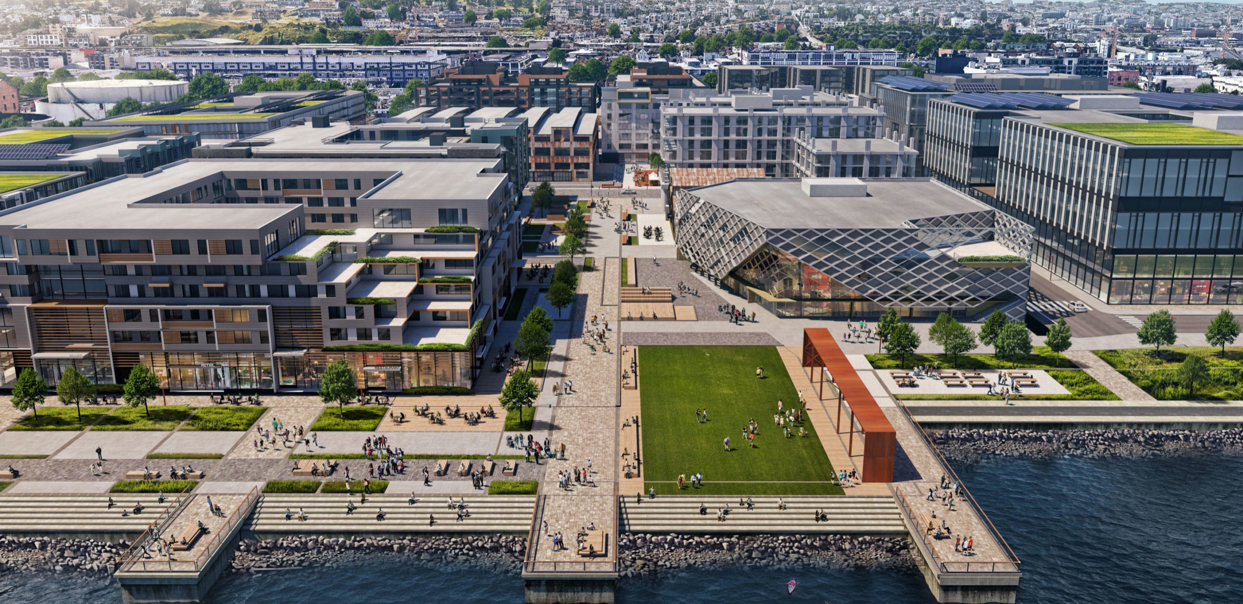
A 28-acre waterfront site in San Francisco’s Dogpatch neighborhood could soon carry a larger residential load. Brookfield Properties is seeking approval to increase the Pier 70 project from 2,150 to approximately 2,750 homes, adding about 600 units without expanding the development footprint. The plan would also include public parks, commercial space, arts and maker uses, and rehabilitation of historic industrial buildings.
That is a major change. It is also the kind of change that deserves to be evaluated like a complicated construction project. Start with the foundation. Then inspect the load-bearing walls. After that, ask whether the public benefits are strong enough to support the added density.
A larger project on a fixed waterfront site
Pier 70 sits along San Francisco’s southern waterfront, between 20th and 22nd streets, adjacent to Dogpatch’s existing residential and industrial fabric. The Port of San Francisco describes the 28-acre site as a mixed-use neighborhood with housing, commercial space, retail, production and repair uses, arts space, historic rehabilitation, parks, and sea-level-rise adaptation features. (Port of San Francisco project page)
Brookfield’s proposal would increase the residential cap by roughly 28 percent. According to recent reporting on the request, several residential buildings would rise from approximately 70 feet to 90 feet, using the maximum height already allowed under the project’s waterfront framework.
The increase is not approved yet. It would require changes to existing project approvals and review by the Port Commission and the San Francisco Board of Supervisors.
That distinction matters. A proposal is not an entitlement. An entitlement is not financing. Financing is not a building permit. And a permit is not a completed neighborhood.
The foundation is more complicated than the unit count
Pier 70 is not a clean, empty pad. It is former industrial waterfront land with a long history of shipbuilding, ironworks, fill placement, buried structures, utilities, historic buildings, and environmental controls.
The project’s infrastructure plan identifies Bay Mud, artificial fill, groundwater, settlement risk, seismic slope movement, and shoreline stabilization as major technical considerations. The plan also calls for geotechnical improvements, grading, stormwater controls, new utilities, fire-suppression infrastructure, and phased construction. (Pier 70 SUD Infrastructure Plan)
That is why adding 600 homes is not simply a matter of placing more apartments on a drawing.
More residents mean higher demands on:
- Water distribution and fire flow
- Combined sewer and stormwater systems
- Electrical capacity and communications
- Loading, emergency access, and construction logistics
- Public open-space maintenance
- Transit and pedestrian connections
- Long-term shoreline monitoring and adaptation
The infrastructure plan was designed around phased development. Each phase must provide complete systems for the buildings it supports while maintaining access to existing facilities and future phases. That is good project discipline. It also means the revised housing program needs to be tested against the actual capacity of each phase, not just the final build-out.
Sea-level rise is the special inspection
The waterfront is the part of this proposal that deserves the most scrutiny.
The Pier 70 infrastructure plan uses an adaptive management approach. That means the site is designed for defined near-term conditions while preserving the ability to make additional improvements as sea levels change. The plan sets different criteria for the shoreline, Bay Trail, open space, and building pads. Building finished floors were planned around a base flood elevation plus a 66-inch sea-level-rise allowance and six inches of freeboard. The Bay Trail was planned around the total water level plus 24 inches of sea-level rise.
That is not a decorative sustainability statement. It is a construction obligation.
The same plan anticipates that the lowest shoreline areas will experience more frequent inundation over time. Erosion protection, drainage, future pump stations, shoreline adjustments, monitoring, and dedicated funding are all part of the long-term strategy.
With more housing, the question becomes simple: does the resilience plan scale with the residential program?
If the answer is yes, the added density can be part of a stronger waterfront district. If the answer is no, the project risks putting more people and more private investment behind infrastructure that was not designed for the revised load.
This is where the Port, city agencies, engineers, and developer need to publish clear answers. What changes to grading are required? What improvements are needed for stormwater and combined sewer capacity? Does the shoreline adaptation tax or other funding mechanism grow with the added units? Who owns future maintenance obligations?
Those are not side questions. They are the inspection report.
Housing delivery versus public benefits
The strongest argument for the upsize is housing delivery on underutilized industrial land.
The proposal would add homes without removing an established residential block. It would place more people near existing and planned transit, including the T Third Street line and 22nd Street Caltrain station. It would also spread major infrastructure and site preparation costs across more units.
That can make a stalled project financially workable. Brookfield has said the additional density is needed to improve feasibility in a difficult construction and financing market.
But public benefits need to carry their share of the load.
The Port’s existing project description includes parks, arts space, replacement studio space, childcare facilities, affordable housing, local hiring, and rehabilitation of historic buildings. The project website describes a district organized around homes, offices, labs, restaurants, art studios, maker spaces, and waterfront access. (Pier 70 project website)
The public should see how those commitments change under the revised plan.
A larger residential program should not produce a smaller public realm per resident. Arts and maker space should not become the first line item cut when costs rise. Public parks should be funded, built, maintained, and connected to the existing Dogpatch street network.
The unit count is visible. The operating commitments are where the real test begins.
Retaining Dogpatch’s industrial character
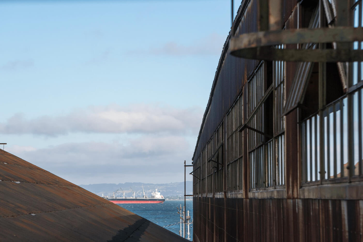
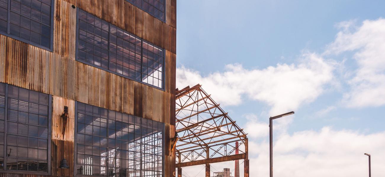
Dogpatch has a distinct physical identity. It is not only a collection of new apartment buildings. Its character comes from working waterfront history, older industrial structures, small businesses, artists, maritime uses, narrow streets, and buildings that show their age.
Pier 70 has an opportunity to extend that identity rather than erase it. The project includes rehabilitation of historic buildings and public spaces around them. The Port’s infrastructure documents identify historic buildings, public plazas, waterfront promenades, Slipways Commons, and a Market Square as important elements of the plan.
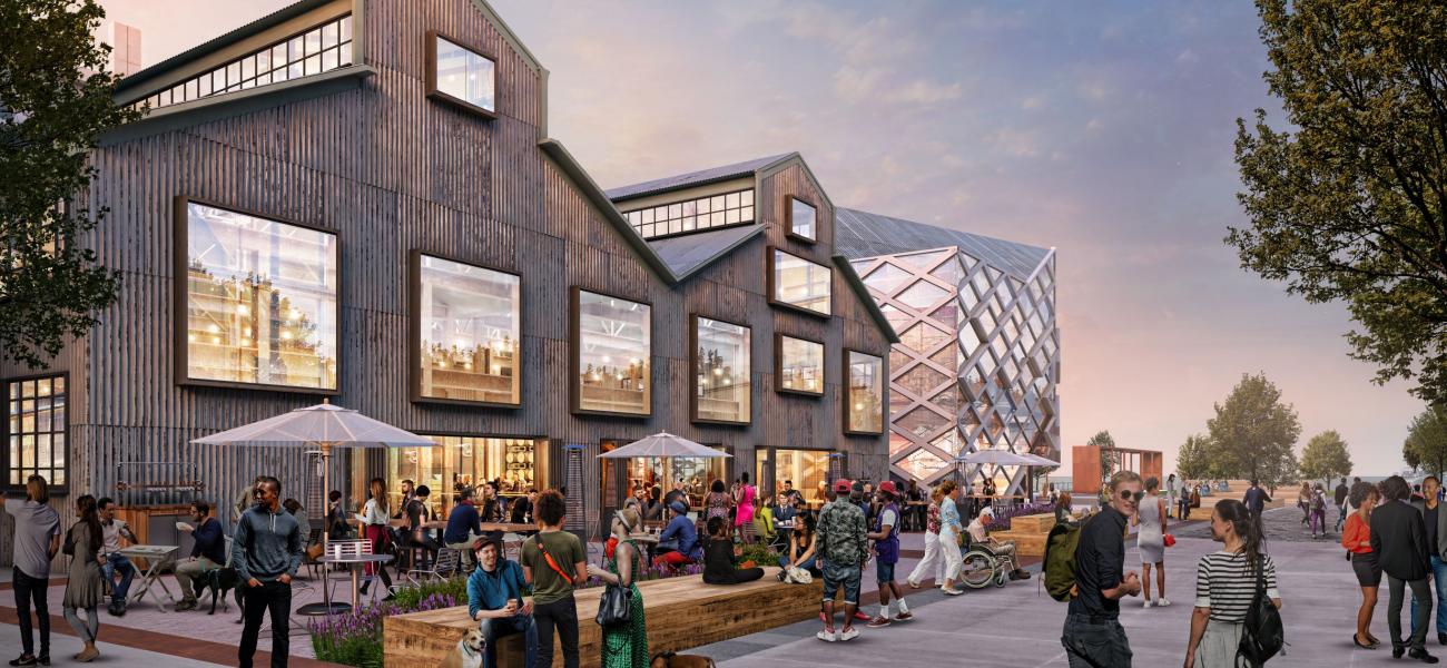
The design challenge is scale. A 90-foot residential building can be compatible with an industrial district if its ground floor, setbacks, materials, public edges, and connections are handled carefully. It can also become a wall that turns its back on the neighborhood.
Construction management has a role here. Historic structures, active businesses, public access, and new vertical construction must be sequenced together. The project cannot treat the old buildings as scenery while new construction controls every decision.
Build the infrastructure first in the schedule
The cleanest way to protect the neighborhood is to make horizontal infrastructure a first-class schedule item.
That includes:
- Utility relocation and capacity verification
- Shoreline and flood protection work
- Fire access and emergency vehicle routes
- Public streets and accessible sidewalks
- Stormwater and combined sewer improvements
- Transit connections and transportation demand management
- Park construction and maintenance agreements
- Environmental controls for soil disturbance and groundwater
- Clear phasing plans for occupied or active portions of the site
The Pier 70 infrastructure plan already establishes a framework for phased streets, utilities, parks, stormwater systems, and emergency access. The revised proposal should update those documents and show how the added units affect them.
A project that delivers 700 homes in its first phase but leaves public access, park construction, or necessary utility work behind is not truly delivering a complete phase. It is delivering vertical construction ahead of the supporting systems.
That is how projects create trouble.
So, is the upsize good for Dogpatch?
Yes, potentially. Waterfront redevelopment on underutilized land can add housing, public access, jobs, cultural space, and parks without displacing an existing residential neighborhood.
But the approval should come with conditions that treat resilience and public benefits as load-bearing elements. The project should show its updated infrastructure demand, shoreline strategy, affordability commitments, arts and maker-space protections, construction phasing, and long-term maintenance responsibilities.
The right question is not whether Dogpatch can absorb 600 more homes. It is whether Pier 70 can support those homes with infrastructure that remains safe, accessible, and maintainable for decades.
That is the difference between adding density and building a neighborhood.
For property owners, developers, and project teams watching the Bay Area waterfront, Pier 70 is a useful case study in complex urban construction. The work involves commercial project planning, residential delivery, historic rehabilitation, infrastructure coordination, environmental controls, and long-term operations. Atlas Premier’s guide to avoiding Bay Area construction budget mistakes covers many of the same planning failures that can affect large, phased developments.
Ready to move your project from concept to completion?
Contact Atlas Premier Services and Consultants today.
Atlas Premier Services and Consultants
Strategic Solutions. Trusted Execution.
Lake Merritt Plaza
1999 Harrison Street, 18th Floor
Oakland, CA 94612
Phone: (800) 994-9028
Email: info@atlas-premier.com
Disclaimer: This content is for general informational purposes only and does not constitute legal, financial, engineering, construction, regulatory, or other professional advice. Reading this content does not create a client or contractual relationship with Atlas Premier Services & Consultants. Because every project and property is different, consult qualified professionals regarding your specific circumstances. Atlas Premier Services & Consultants makes no warranties regarding the accuracy or completeness of this information and is not responsible for third-party content or references. Testimonials, examples, and case studies are illustrative only and do not guarantee similar results.