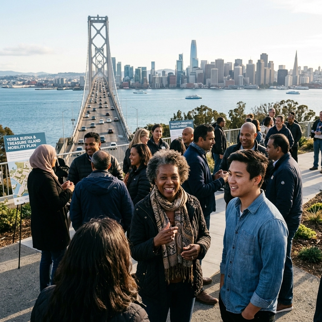
The Bridge to the Future
If you’ve driven across the San Francisco-Oakland Bay Bridge lately, you have seen the silhouette of Yerba Buena Island shifting in real-time. It isn't just a rocky outcrop or a tunnel entrance anymore. It is becoming a neighborhood. For decades, the twin islands of Yerba Buena and Treasure Island served as a quiet, somewhat decaying relic of naval history. Today, they represent the most ambitious urban expansion in San Francisco’s modern history. But building 8,000 new housing units in the middle of the Bay presents a logistical nightmare: how do you move thousands of people on and off a rock without paralyzing one of the world's busiest bridges? [1]
The answer is a massive, $350 million mobility investment that is finally hitting its stride. This isn't just about paving roads. It is a complex web of seismic retrofitting, ferry terminal expansion, and high-altitude pedestrian paths designed to make car ownership optional for island residents. From the $126 million West Side Bridges Seismic Retrofit to the intricate "Sand Jail" soil stabilization techniques, the engineering required here is as steep as the island's cliffs. [2]
This post explores the massive infrastructure work required to support the Bay Area’s housing growth. You will learn:
- The breakdown of the $350 million mobility and connectivity budget.
- The unique engineering challenges of the "Sand Jail" soil-nail walls and military ordnance removal.
- How non-vehicular transit (bikes, ferries, and shuttles) will serve as the primary lifeline for 20,000 new residents.
A Vision for 8,000 Front Doors
The scale of the Treasure Island Development Authority (TIDA) master plan is hard to wrap your head around. We are talking about a brand-new neighborhood that will eventually house more people than the city of Sausalito. The plan calls for 8,000 homes, with 27.2% of those units designated as affordable housing (San Francisco County Transportation Authority) [3]. To support this, the city cannot rely on the existing Bay Bridge off-ramps, which were never designed for high-density residential traffic.
The evolution of these islands is a case study in transit-oriented development. Instead of building massive parking garages, the city is betting on a "multi-modal" future. This means a heavy reliance on the ferry system, a network of on-island shuttles, and a bike path that will eventually connect the East Bay Hills to the Embarcadero. For a general contractor or developer, this is a masterclass in how development services must integrate with public infrastructure to be viable. [4]
The $126 Million Backbone: West Side Bridges
One of the most critical components of this mobility plan is the Yerba Buena Island West Side Bridges Seismic Retrofit. This $126 million project, managed by the Golden State Bridge-Obayashi Joint Venture, is tasked with ensuring the island’s primary arteries can withstand a major earthquake (Engineering News-Record) [5]. These aren't standard bridges; they are high-consequence structures carved into the side of a steep, unstable slope.
The project involves replacing or retrofitting ten separate bridge structures that wind around the western side of the island. Construction crews have had to navigate incredibly tight footprints while keeping traffic flowing to the existing residences and the Coast Guard station. It is the kind of high-stakes general contracting work that defines the current era of Bay Area infrastructure. [2]

Engineering the "Sand Jail"
Working on Yerba Buena Island is a vertical challenge. The slopes are nearly vertical in some places, consisting of loose soil and fractured rock. To stabilize the ground for the new multi-use paths and bridge supports, engineers utilized a "Sand Jail" soil-nail wall system (SFCTA) [3]. This involves drilling hundreds of long steel tendons into the hillside and grouting them in place, essentially "pinning" the mountain to itself.
This soil-nailing process is essential for the Yerba Buena Multi-Use Path, which will eventually allow pedestrians and cyclists to traverse the island with stunning views of the San Francisco skyline. But it isn't just about the dirt. The team also had to contend with the island’s past as a military base. During excavation for the bridge footings, crews had to implement strict "unexploded ordnance" (UXO) protocols, a reminder of the island's history as a Naval Training Station (U.S. Navy) [6].
Funding the Flow: The $45M Housing and Mobility Grant
Infrastructure this complex requires a patchwork of funding. Recently, a $45 million grant from the California Department of Housing and Community Development’s (HCD) Infill Infrastructure Grant program provided a major boost. This money is specifically earmarked to link affordable housing developments on Treasure Island with the larger mobility network (TIDA) [7].
The grant ensures that the "Island Evolution" isn't just for luxury condo buyers. By funding the Yerba Buena Multi-Use Path and the initial phases of the transit hub, the city is ensuring that lower-income residents have reliable, non-car access to jobs in San Francisco and Oakland. This is a critical component of development in the modern Bay Area, infrastructure must serve everyone. [1]
Moving Beyond the Car: Ferries and Shuttles
The Treasure Island Mobility Management Agency (TIMMA) is the "brain" behind the transit strategy. Their goal is simple: reduce car trips by 50% (SFCTA) [8]. To achieve this, they are implementing a world-class ferry terminal on the western edge of Treasure Island. Ferry service is already operational, offering a 10-minute commute to the San Francisco Ferry Building.
But a ferry terminal only works if people can get to it. That’s where the on-island shuttle system comes in. These shuttles are designed to be frequent and reliable, connecting the hilltop residences of Yerba Buena with the flatlands of Treasure Island. This level of interiors and exterior planning ensures that the entire island feels like a connected campus rather than a disconnected series of buildings. [9]

Comparison of Key Mobility Projects
| Project Name | Primary Contractor / Agency | Estimated Cost | Key Objective |
|---|---|---|---|
| West Side Bridges Retrofit | GSB-Obayashi JV | $126 Million | Seismic safety for primary island roads [2] |
| YBI Multi-Use Path | SFCTA / TIDA | $45 Million (Grant) | Pedestrian and bike connectivity [7] |
| Wastewater Treatment Plant | TIDA | $165 Million | Sustainable utility infrastructure [10] |
| Ferry Terminal Phase 1 | Power Construction | $50 Million | High-capacity transit to SF [8] |
| Southgate Road Realignment | Ghilotti Construction | $38 Million | Improved access to East Side [3] |
The "Sand Jail" Case Study: Stabilizing the Southgate Road
A defining moment in the mobility plan occurred during the Southgate Road Realignment. The project required cutting into a 70-degree slope to create a wider roadway for transit vehicles. Traditional retaining walls were impossible due to the lack of a "heel" or base at the bottom of the cliff.
Engineers turned to a hybrid soil-nail wall and shotcrete system. Over 400 nails were driven 30 to 50 feet into the Franciscan complex rock (California Department of Transportation) [11]. The "Sand Jail" nickname comes from the way the reinforced earth is held in place by the grid of nails and mesh. Despite the complexity, the project was completed on time, allowing the subsequent bridge work to begin. This highlights the exteriors expertise needed to build on the Bay Area’s unique topography. [5]
What Smart Critics Argue
While the $350 million mobility plan is a feat of engineering, it has not been without its detractors.
1. The Toll Controversy: Critics, including local residents and some SF Supervisors, have argued that the proposed "congestion toll" for driving on and off the island is an unfair tax on a captive population (San Francisco Chronicle) [12].
- Response: TIMMA maintains that without the toll, the Bay Bridge ramps would reach total gridlock within three years of the island reaching 50% occupancy. The toll revenue is also the primary funding source for the "free" on-island shuttles.
2. Gentrification Concerns: Some argue that the high cost of infrastructure will inevitably lead to higher home prices, pushing out the very people the affordable housing is meant to serve (SF Public Press) [13].
- Response: The $45 million HCD grant is specifically designed to decouple infrastructure costs from affordable housing development, ensuring those units remain viable.
3. Environmental Impact: Environmental groups have raised concerns about the impact of increased ferry traffic and dredging on Bay ecosystems (Baykeeper) [14].
- Response: The ferry terminal project underwent a rigorous CEQA review and includes state-of-the-art low-emission vessels and habitat restoration as part of the TIDA master plan.
Project Timeline: A 30-Year Evolution
- 1996: Naval Station Treasure Island officially closes; planning for civilian reuse begins [6].
- 2011: San Francisco Board of Supervisors approves the Treasure Island Master Plan [3].
- 2016: Groundbreaking on the first phase of infrastructure (utilities and roadways) [1].
- 2018: Construction begins on the Yerba Buena Island West Side Bridges Seismic Retrofit [2].
- 2021: The first residents move into the "Bristol" condominiums on Yerba Buena Island [9].
- 2022: Permanent ferry service launches between Treasure Island and San Francisco [8].
- 2024: $45 million grant awarded for the Yerba Buena Multi-Use Path and affordable housing [7].
- 2025: Expected completion of the West Side Bridges Seismic Retrofit (Estimated) [5].
- 2026: Target opening for the first major affordable housing block on Treasure Island [1].
- 2035: Full build-out of all 8,000 units expected [3].
Key Takeaways
- Infrastructure First: You cannot build 8,000 homes without a $350M+ plan for how people will move.
- Seismic Priority: The $126M West Side Bridges are the literal foundation of the island's safety [2].
- Non-Car Future: The goal is a 50% reduction in car dependency through ferries and shuttles [8].
- Engineering Difficulty: Soil-nail walls and UXO removal make this one of the hardest builds in the state [11].
- Affordability Integration: Grants like the $45M HCD award ensure infrastructure supports all income levels [7].
- Sustainability: The wastewater plant and recycled water systems complement the transit goals [10].
- Economic Engine: These projects are massive job creators for Bay Area trades and contractors [5].
Actions You Can Take
At Work
If you are a developer or contractor, study the TIDA project as a model for "infill infrastructure." Look at how the design-build and joint-venture models are being used to mitigate risk on these high-complexity sites.
At Home
Stay informed about the TIMMA tolling policies. If you live in San Francisco, these policies will likely become a blueprint for future congestion pricing in other parts of the city.
In the Community
Support local organizations like SF New Deal or the Treasure Island Community Development (TICD) outreach programs. They often host tours and information sessions about the island's progress.
In Civic Life
Advocate for continued state funding of the Infill Infrastructure Grant program. This program is the only reason the affordable housing components of Treasure Island remain financially feasible.
Extra Step
Take the ferry! The best way to understand the scale of the island’s evolution is to see it from the water. It’s a $5 commute that offers a front-row seat to the future of San Francisco’s skyline.
FAQ
Will there really be a toll to visit Treasure Island?
Yes, the current plan includes a congestion toll for non-residents during peak hours. Residents will have various exemptions and credits, but the goal is to discourage single-occupancy vehicle trips [12].
Is it safe to live on an island with a history of military waste?
The Navy and the EPA have conducted extensive remediation. All new construction occurs on land that has been cleared and certified for residential use. The ongoing UXO monitoring during construction is a standard safety protocol [6].
How do I get my bike to the island?
Currently, the Bay Bridge East Span path takes you to Yerba Buena Island. The $45M mobility grant is currently funding the completion of the "West Side" connection, which will eventually allow for a seamless bike trip from Oakland to the Treasure Island Ferry terminal [7].
When will the housing be finished?
It’s a 20-year project. While several buildings are already open on Yerba Buena Island, the bulk of the Treasure Island flatlands construction will continue through the early 2030s [3].
What happens in a major earthquake?
The $126M West Side Bridges retrofit is specifically designed to ensure the island remains accessible to emergency vehicles even after a "design-level" seismic event [2].
Atlas Premier Services & Consultants is a premier general contracting and project management firm dedicated to high-performance commercial and residential development, management, janitorial, maintenance, etc. From commercial offices to complex medical facilities, we bring a standard of excellence to every square foot we manage.
Service Areas: San Francisco, Oakland, San Jose, and the greater Bay Area.
Atlas Premier Services and Consultants
Strategic Solutions. Trusted Execution.
Lake Merritt Plaza
1999 Harrison Street, 18th Floor
Oakland, CA 94612
(510) 726-2433
info@atlas-premier.com
www.atlas-premier.com
Ready to move your project from concept to completion?
Contact Atlas Premier Services and Consultants today.
Sources
[1] San Francisco Chronicle, “Treasure Island’s $6 Billion Reimagining,” August 2023, sfchronicle.com, Accessed May 10, 2026.
[2] Golden State Bridge-Obayashi JV, “Yerba Buena Island West Side Bridges Project Summary,” March 2024, gsbridge.com, Accessed May 10, 2026.
[3] SFCTA, “Treasure Island and Yerba Buena Island Development Project Update,” January 2025, sfcta.org, Accessed May 10, 2026.
[4] Atlas Premier Services & Consultants, “Development Services,” atlas-premier.com, Accessed May 10, 2026.
[5] Engineering News-Record, “$350M in Mobility Work Preps Bay Area Islands,” February 2024, enr.com, Accessed May 10, 2026.
[6] U.S. Navy, “Base Realignment and Closure: Naval Station Treasure Island,” navy.mil, Last updated December 2025, Accessed May 10, 2026.
[7] TIDA, “Affordable Housing and Infrastructure Grant Announcement,” April 2026, sftreasureisland.org, Accessed May 10, 2026.
[8] TIMMA, “Treasure Island Ferry Terminal and Service Plan,” November 2023, sfcta.org/timma, Accessed May 10, 2026.
[9] Yerba Buena Island Real Estate, “The Bristol and the Townhomes Development Status,” yerbabuenaisland.com, Accessed May 10, 2026.
[10] SF Water Power Sewer, “Treasure Island Wastewater Treatment Plant Construction,” sfpuc.org, Accessed May 10, 2026.
[11] Caltrans, “Soil Nail Wall Design Standards for Steep Slope Stabilization,” dot.ca.gov, Accessed May 10, 2026.
[12] San Francisco Chronicle, “The Battle Over Treasure Island Tolls,” October 2025, sfchronicle.com, Accessed May 10, 2026.
[13] SF Public Press, “Housing Equity on the Island,” March 2024, sfpublicpress.org, Accessed May 10, 2026.
[14] Baykeeper, “Protecting the Bay During Treasure Island Expansion,” baykeeper.org, Accessed May 10, 2026.
Disclaimer: This content is for general informational purposes only and does not constitute legal, financial, engineering, construction, regulatory, or other professional advice. Reading this content does not create a client or contractual relationship with Atlas Premier Services & Consultants. Because every project and property is different, consult qualified professionals regarding your specific circumstances. Atlas Premier Services & Consultants makes no warranties regarding the accuracy or completeness of this information and is not responsible for third-party content or references. Testimonials, examples, and case studies are illustrative only and do not guarantee similar results.